
Saranda Forest

HIDDEN GEMS · WILDLIFE · TREK · West Singhbhum

Saranda Forest

Saranda hills, endless Sal forests, and a road into the wild

4.5

Beauty

4.5

Photo

4.0

Safety

3.0

Crowd

The Story

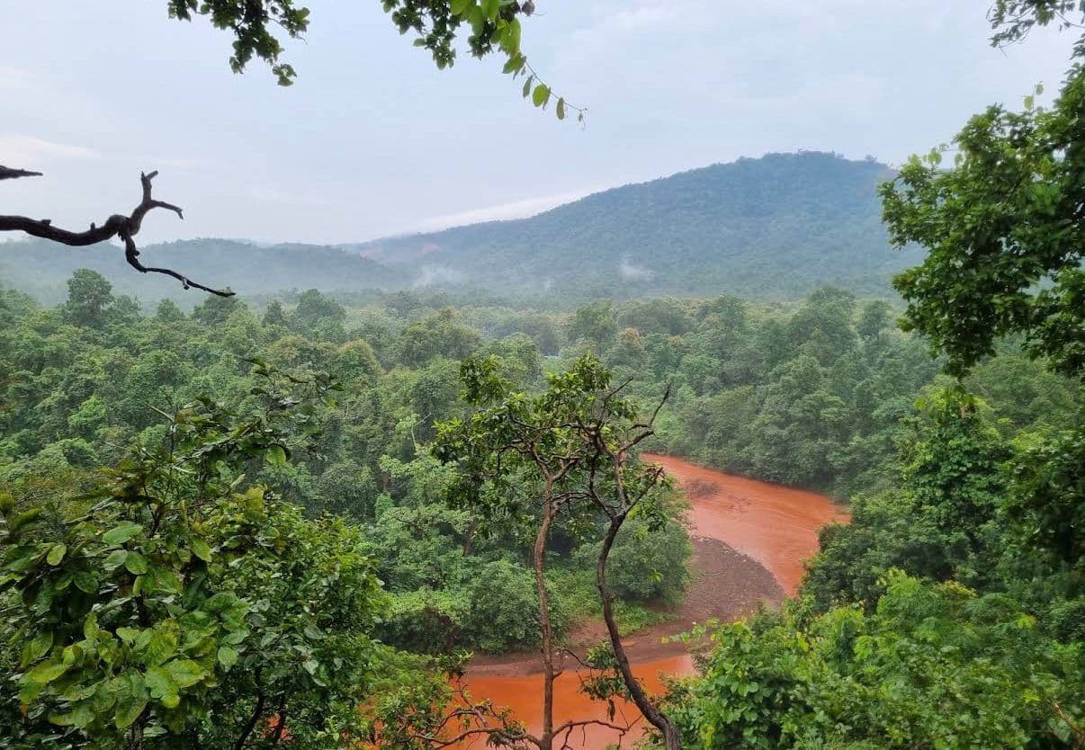
Saranda Forest is not really a place you “see” in one afternoon. It is an entire landscape that unfolds as you drive deeper into West Singhbhum. The name Saranda is traditionally associated with the “land of seven hundred hills,” and the forest is famous for its enormous stretches of Sal trees, rolling hills and rich wildlife. The forest covers roughly 900 sq. km, according to Jharkhand Tourism, making it one of the state's most significant forest landscapes. The best way to experience Saranda is slowly. Take the road through the forest, stop at safe viewpoints, listen to the forest around you and explore destinations such as Kiriburu, Meghahatuburu and nearby waterfalls along the way. The landscape changes with the season: in the monsoon, everything becomes intensely green, while winter brings clearer skies and comfortable weather for exploring. The Sal forest is also home to a remarkable variety of birds, reptiles and mammals, with elephants being particularly associated with the region. Saranda is part of an important elephant movement corridor, so this is very much a place where the forest remains in charge. ⚠️ Safety Points Do not treat Saranda like an ordinary picnic forest. It is a large, wildlife-rich forest landscape. Elephants are a major safety consideration. Never approach, chase, photograph from very close, honk at or attempt to feed an elephant. Saranda forms part of an elephant corridor. Avoid travelling through isolated forest stretches after dark. Stay on established roads and permitted trails. Do not enter restricted forest areas. Carry sufficient fuel, drinking water and basic first aid because facilities become limited deeper inside the forest. Mobile connectivity can be inconsistent in remote stretches. During monsoon, be cautious of slippery roads, fallen trees, streams and reduced visibility. Do not wander into the forest looking for wildlife. Let wildlife remain wild. Respect local Ho communities and sacred/cultural spaces.

Destination DNA

How this place scores across KHOJ's 10 travel dimensions.

Spiritual
Heritage
Nature
Water
Adventure
Tribal
Photo
Family
Road Trip
Hidden Gem

Amenities

Deep forestTrekking trailAsk permissions from forest departmentView pointwildlife spotting

Community · 0 Reviews

No reviews yet. Be the first to share your experience.

Visitor Info

Entry

No standard general-entry fee,Specific forest areas, activities or permissions may have separate requirements.

Best Time

Monsoon is spectacularly green but can make forest roads and visibility more difficult.

Duration

Half day to 2 days, depending on whether you are exploring only the forest or combining it with Kiriburu, Meghahatuburu and nearby waterfalls.

Distance

View on Map

How To Reach

—

Distance · km

From you

  • Nearest city

    Barbil, Odisha: ~28 km from Meghahatuburu , Jamshedpur: ~122 km to the Saranda region Chaibasa: ~60 km from the main access side of Saranda Chakradharpur: ~89 km from Jamshedpur

  • Nearest railway

    Barajamda Railway Station: ~24 km from Kiriburu/Meghahatuburu

  • Nearest airport

    Birsa Munda Airport -200+ km

  • By road

    Chaibasa is the principal road access point into Saranda. The forest can also be approached through Chakradharpur and Manoharpur. For the Kiriburu–Meghahatuburu side, Barajamda is the nearest railway access, approximately 24 km away.

Nearby in West Singhbhum

Hostels, hotels, food, guides and SOS around this destination

Nearby hostels

District · West Singhbhum

View all hostels

No hostels listed nearby yet.

Browse all hostels

Nearby hotels

District stays near this destination

Test Hotel
★★★137 km

Test Hotel

Test Hotel

₹2,000/night

4
Ranchi Central Inn
Premium
★★★138 km

Ranchi Central Inn

City stay for waterfall & island day trips

₹3,200/night

4
Green Valley Stay Ranchi
★★141 km

Green Valley Stay Ranchi

Quiet rooms near Ring Road

₹2,800/night

3.9
Getalsud Backpackers Hostel
★★153 km

Getalsud Backpackers Hostel

Dorm beds near Rose Island jetty

₹699/night

4.3
Getalsud Lake View Stay
Premium
★★★154 km

Getalsud Lake View Stay

Rooms overlooking the reservoir

₹3,500/night

4.4
View all hotels (6)

Nearby restaurants

Food near this destination

View all
Dalma View Dhaba

Dalma View Dhaba

129 km

Multi-cuisine

4.2₹900 for two
Tribal Kitchen Ranchi

Tribal Kitchen Ranchi

138 km

Jharkhandi

4.5₹800 for two
Dam Side Dhaba Getalsud

Dam Side Dhaba Getalsud

154 km

Multi-cuisine

4.2₹700 for two
Island View Cafe

Island View Cafe

154 km

Cafe · Veg

4.3₹550 for two
Pine View Cafe

Pine View Cafe

186 km

Cafe · Veg

4.1₹600 for two

Nearby guides

Local guides for West Singhbhum

View all guides

TEST

★ 4.5 · 0 yrs

₹0/dayBook

guide

★ 4.5 · 0 yrs

Chatra, Hazaribagh

₹0/dayBook

Local guides

★ 4.5 · 0 yrs

Ranchi

₹500/dayBook

guide raj

★ 4.5 · 0 yrs

Ranchi, Chatra

₹1,000/dayBook

TEST ADVENTURE

★ 4.5 · 0 yrs

₹0/dayBook

SOS near this place

Hospital, police and ambulance near this destination

Full SOS
  • Kuchai PS

    Kuchai PS, Saawanraikela-Kharsa

    93.5 km away

  • Summer Hospital & Research Centre Pvt ltd

    Kama Chowk , Khunti - Chaibasa Rd , Singh More , Hatia , Ranchi 834003, Jharkhand , India

    133.2 km away

  • PARAS HEC Hospital

    Near Prabhat Tara School , Khataal, Dhurva , Ranchi , 834004, India

    134.3 km away

  • Apollo Hospitals

    Main Road, Ranchi

    139.1 km away

  • Raj Hospital

    Raj Hospital Complex , Behind Ranchi Central, Ranchi 834001 ,Jharkhand , India

    139.2 km away